&w=3840&q=75)
&w=3840&q=75)
&w=3840&q=75)
&w=3840&q=75)
&w=3840&q=75)
&w=3840&q=75)
&w=3840&q=75)
&w=3840&q=75)

8
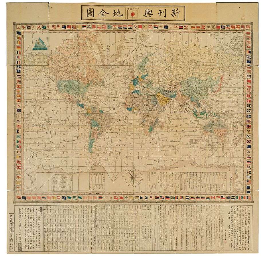
SATO MASAYASU SHINKAN YOSHI ZENZU [NOUVELLE VERSION DE LA CARTE DU MONDE]
The item was sold for 1 115 €
Fees include commission and taxes.
SATO MASAYASU SHINKAN YOSHI ZENZU [NEW VERSION OF THE WORLD MAP].
Folding map in 24 attached sheets printed on paper and colored.
Map of the world in Mercator projection, surrounded by 159 flags of nations, including numerous trade and sea exploration routes, details of mountains, rivers and other places of interest...
Dated Bunkyu 1 (1862). Published in Edo by Yorozuya Heishiro, engraved by Takeguchi Takisaburo and Uemura Fukusaburo.
Dim. 1340 x 1340 mm
NOTE: This map is the first world map in Mercator projection published in Japan, and a major advance in Japanese cartography. According to the text in the lower margin, it is based on an 1857 world map by the Dutchman C.F. Stemler. It gives many details of world geography, including the circumnavigation of Australia, details of the northwest coast of North America and the Bering Strait, the emergence of Antarctica... On the geopolitical front, this map introduces the new world order after the Napoleonic Wars, the colonial phenomenon with British India, French Indochina and the Dutch East Indies, as well as the new borders of the United States and a newly independent South America, now made up of several states.