&w=3840&q=75)
&w=3840&q=75)
&w=3840&q=75)
&w=3840&q=75)
&w=3840&q=75)
&w=3840&q=75)
&w=3840&q=75)
&w=3840&q=75)


303
[ATLAS]. TASSIN (Christophe) Les plans et profils de toutes les principale
The item was sold for 1 089 €
Fees include commission and taxes.
[ATLAS]. TASSIN (Christophe) Les plans et profils de toutes les principales villes et lieux considérables de France.
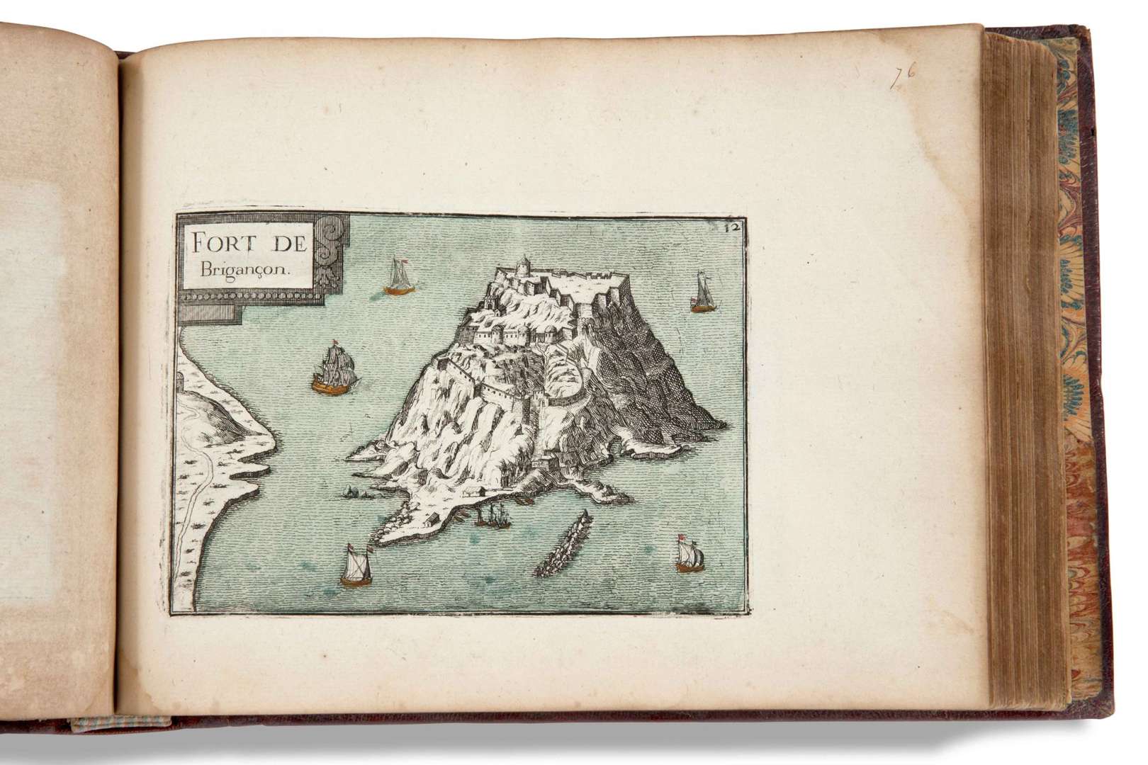
Ensemble les cartes générales de chaque province| et les particulières de chaque gouvernement d'icelle. Paris, Jean Messager, 1636. 10 parts in 1 vol. in-4 oblong (17.5 x 24 cm. excluding binding), 44 p., [219] engraved leaves, contemporary red morocco, 5-rib spine, gilt title, ornate caissons, multiple gilt fillets framing the boards, gilt scrolls on the edges, gilt edges (spine replaced, original fragments reassembled, restoration to lower board, rubbing and staining to boards, a few browned pages, marginal defects, including wetness, worm work on lower margin of pl. 24-37 of Languedoc part, and tiny pitting on pl. of Foix and Béarn part| 11 plates lacking in last part).
Second part of this important atlas illustrating the entire kingdom of France in the early 17th century. Devoted to the southern part of the country, it comprises 10 parts, preceded by 44 pages of text (including the title), and covers the following regions:
Burgundy: 24 plates, including title, table and general map of France. - Dauphiné: 40 plates (including title and table). Provence: 19 plates (including title and table). - Orange &| Comtat Venaissin: 5 plates.
(including title). - Languedoc: [1] title page, 46 plates (including table). - Foix and Béarn: 7 plates (including title). - Guyenne: 23 plates (including title and table).
- Poitou: 26 plates (including title and table). - Loire River: [2] f. (title, table), 17 plates - Beauce: 9 of 18 plates (including title and table| this part is missing 11 plates).
Old handwritten table on a flyleaf and extended on the title page| old annotations in the general text referring to the plates. All leaves (title, tables and plates) were formerly numbered continuously in ink, from 1 to 219.
(Pastoureau, Tassin VIII Bb)