&w=3840&q=75)
&w=3840&q=75)
&w=3840&q=75)
&w=3840&q=75)
&w=3840&q=75)
&w=3840&q=75)
&w=3840&q=75)
&w=3840&q=75)


17
• [CARTOGRAPHIE]. MICHELOT [Henri] (16..-17..) - BREMOND [Jean André]
Estimate2 000 - 2 500 €
[CARTOGRAPHY]. MICHELOT [Henri] (16..-17..) - BREMOND [Jean André]
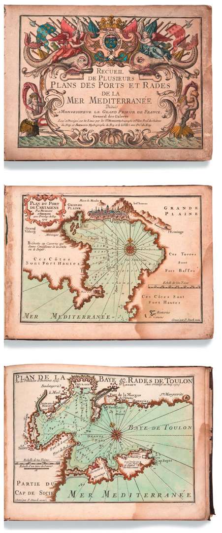
Recüeil de plusieurs plans des Ports et Rades de la Mer Méditerranée.
Dedicated to Monseigneur le Grand Prieur de France, Général des Galères
S.l.n.d. [Marseille, L. Brémond, 1727-1730]. In-8 oblong (215 x 295 mm), 37 plates, full brown calf, spine with gilt fleurons and titling, red edges (period binding).
Very important and interesting atlas of plans of the Mediterranean ports drawn up by Michelot and Brémond.
It is illustrated with a title-frontispice and 37 maps engraved in tailledouce by P. Starckman, dated 1727 or 1730 and enhanced with charming colours. The maps represent the ports of Gibraltar, Majorca, Barcelona, Collioure, Sète, Hyères, Antibes and others. They are exceptionally detailed and reflect the talent of Peter Starckman, one of the most fashionable map engravers of the time.
RARE colour-enhanced copy.
PROVENANCE Horace Finaly Library (Binding very worn| old wetness at lower right affecting the plates, f.
title-frontispiece browned and slight tears in the margin).