&w=3840&q=75)
&w=3840&q=75)
&w=3840&q=75)
&w=3840&q=75)
&w=3840&q=75)
&w=3840&q=75)
&w=3840&q=75)
&w=3840&q=75)

[ATLAS]
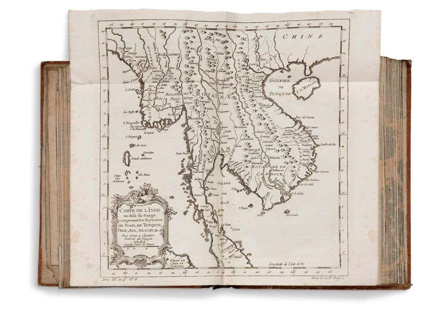
An old collection of 69 18th century maps, single, double or folding, most of them engraved after Jacques-Nicolas Bellin's, Laurent's or Cook's tracings. In-4, half basane, spine ribbed and decorated, spine gilt (18th century binding).
Among other things, there is a large world map and special maps of Africa and Arabia, the Far East and South-East Asia, America, etc. Some of his maps accompany Abbé Prevost's "L'histoire Générale des Voyages" and refer simultaneously to the
in-4 and in-12 editions.
Jacques-Nicolas Bellin is a cabinet cartographer. It analyzes, classifies and stores the charts and voyage reports that ship masters file on their return from a voyage. Bellin is one of those who attach great importance to descriptions of coasts, harbours, ports and fortified places on the edge of oceans and/or rivers, to the detriment of inland descriptions of
continents.
Other maps are taken from the "Carte Françoise de l'Océan Oriental" published by order of the Comte de
Maurepas.
Flattened cap, blunt corners, cards free of freckles and very fresh. Very nice atlas gathering the most beautiful maps on
travel.
List of maps on
request.
0-